Hard-to-reach sites
Maintain visibility when travel is costly, delayed, unsafe, or impractical
SF Realty provides authorized satellite, drone, and local visual updates for high-value properties, routes, plantations, mining sites, and family-office assets — delivered as secure maps, photos, timelines, and executive briefings
SF Realty helps owners, operators, advisors, and family offices understand what is happening at remote assets through authorized visual monitoring, secure reporting, and clear escalation rules
Maintain visibility when travel is costly, delayed, unsafe, or impractical
Use visual updates, maps, and timelines to reduce uncertainty
Identify changes in access, activity, condition, or schedule before they become larger issues
Remote assets and complex routes are difficult to inspect consistently. Site visits can be slow, expensive, unsafe, or dependent on local reporting that may be incomplete. SF Realty gives owners, operators, advisors, and family offices independent visual updates so they can understand what changed, when it changed, where it happened, and whether action is needed
Monitoring scopes are customized by asset type, geography, access rules, available imagery, and reporting cadence
We agree on the asset, route, site, geography, monitoring purpose, cadence, reporting format, and escalation rules
Depending on the scope, updates may include satellite imagery, authorized drone capture, approved local visual updates, map references, and publicly available operational context
Visual, geographic, and asset-related indicators are reviewed and organized into clear status notes, timelines, and map-based summaries
Clients receive concise reports through agreed secure channels, with photos, maps, timelines, condition notes, and recommended next steps where relevant
When a material change is identified within the agreed scope, SF Realty notifies approved contacts with a short escalation summary
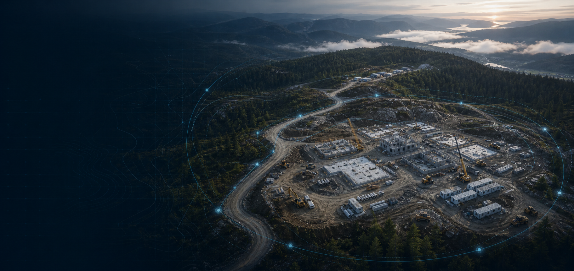
Problem: Site visits are slow, costly, or difficult to arrange for a remote development or acquisition
Monitoring scope: Construction progress, site access, nearby activity, environmental changes, and visible signs of delay, damage, encroachment, or misuse
Client receives: Photos or video where available, map-based updates, progress snapshots, change notes, condition summary, and executive briefings via secure channels

Problem: Shipping activity can require independent visibility over cargo movement, route reliability, port-side conditions, and potential disruptions
Monitoring scope: Route status, vessel and port activity checks, weather and disruption assessment, waypoint updates, and visual verification where available
Client receives: Route status notes, port and vessel activity summaries, disruption notices, timeline updates, and management briefings

Problem: Owners, financiers, insurers, and advisors may need clearer visibility over remote mining operations and visible site activity
Monitoring scope: Access roads, equipment presence, extraction areas, stockpiles, perimeter changes, and nearby infrastructure
Client receives: Satellite-based site comparisons, authorized drone imagery where permitted, infrastructure observations, activity summaries, and condition-focused notes

Problem: Cargo moving across multiple borders can face remote checkpoints, changing road conditions, limited real-time reporting, and unexpected delays
Monitoring scope: Authorized route visibility, shipment-status checks, waypoint confirmation, delay monitoring, border-crossing timeline updates, and disruption assessment
Client receives: Route status updates, checkpoint and waypoint notes, delay and disruption notices, map-based summaries, and condition-focused management briefings

Problem: Mountainous plantation areas can be difficult to inspect regularly because of terrain, weather, distance, and limited site access
Monitoring scope: Plantation-area condition, road access, surrounding activity, weather-related impact, environmental change, and visible signs of damage, disruption, or unauthorized use
Client receives: Satellite and authorized drone imagery where permitted, plantation condition updates, access-road observations, crop-area visual summaries, change-detection notes, weather-impact monitoring, and secure executive briefings

Problem: Family offices, private owners, and advisors may need authorized visibility over residences, high-value assets, travel-related logistics, or confidential asset locations
Monitoring scope: Asset and location awareness, access conditions, route or site-condition updates, visible change indicators, secure communication, and escalation when material changes are identified
Client receives: Residence and asset-status updates, route and access-condition notes, visible change indicators, event-based notices, secure family-office briefings, escalation summaries, and confidential communication with authorized contacts only

Photos, video, satellite imagery, authorized drone imagery, and map references where available
Timeline-based comparison of visible changes across the asset, site, or route
Clear location references, route notes, access observations, and issue markers
Short explanations of visible issues, unusual changes, or conditions that may require attention
Concise summaries for owners, advisors, operators, insurers, or family-office teams
Event-based notices when a material change is identified within the agreed scope
SF Realty operates only within a clearly defined and authorized scope. We do not conduct unauthorized monitoring, trespass, access restricted areas, or collect information outside the agreed asset-monitoring purpose.
Monitoring is performed only for legitimate asset-related, operational, or client-authorized purposes. Drone-based and satellite work is used only where legally permitted, properly authorized, and compliant with applicable airspace, privacy, and safety requirements.
SF Realty focuses on assets, sites, routes, and visible operational conditions — not private individuals. Client information, project details, reports, imagery, and communications are handled confidentially and shared only with authorized parties.
Share the asset, route, or site you need visibility on. We will confirm scope, available sources, reporting cadence, and next steps
Monitoring is conducted only for authorized asset-related purposes and within an agreed scope. Drone-based and satellite work is used only where legally permitted, properly authorized, and compliant with applicable airspace, privacy, and safety requirements.
No. SF Realty focuses on assets, sites, routes, and visible operational conditions. We do not provide unauthorized monitoring of private individuals.
No. SF Realty does not trespass, bypass access restrictions, or enter private property without authorization.
Depending on the scope, reporting may include satellite imagery, authorized drone capture, approved local visual updates, map references, timeline updates, and publicly available operational context.
Monitoring cadence depends on the engagement. Updates may be daily, weekly, event-based, or scheduled around specific project milestones or logistics windows.
Reports typically include visual status updates, map references, timeline notes, condition observations, flagged changes, and concise executive summaries.
Yes. SF Realty can support monitoring for remote sites, routes, and assets where direct access is limited. Depending on the scope, updates may rely on satellite imagery, authorized drone capture, map references, local visual checks, and publicly available operational context.
Yes. Reports and communications are delivered only through agreed secure channels and shared only with authorized client contacts.